

Awakino Saddle, Black Daisies
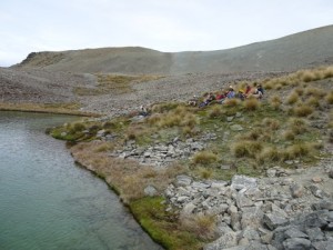
Lunch at the tarn
24th January 2016
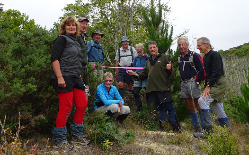
Sunday 24th proved to be a fine interlude in an otherwise unsettled period of easterly weather. It was pleasantly mild and, although the sky darkened in the afternoon, the rain held off and a strong easterly breeze came and went. Eight trampers travelled in two 4WDs from Oamaru, including five club members (Linda, Neville, Jane, Ross and John), one prospective member (Hugh), Zuni Steer from Forest and Bird, and Hugh Wood, NZ Alpine Club member and acknowledged expert on the plants of the St Marys Range. They met another four in Kurow: Club members Helen and Rodney, OTMC member Janet and her son Russell. Three vehicles were driven in to the carpark at the bottom of the Awakino ski field road (81km from Oamaru) where the Kurow four transferred to the two 4WDs which took all twelve the 4km up to park by the ski huts.
Booted up, the twelve headed up the 4WD track to the saddle at about 1700m on the main St Marys Range ridge. There, the party split. One (Zuni) stayed to fossick around the saddle and lower part of the ridge leading to Te Kohurau. Helen and Rodney headed north-west up the main ridge to Rocky Top (1942m) whence they turned south down into the valley towards the tarn. The main party of nine followed Hugh Wood on a journey of exploration west across the upper reaches of the valley leading down to Hut Creek. On the way they were introduced to an amazing variety of plant associations uniquely adapted to the differing environments in an area which, to the uneducated eye, looked like barren scree.
The tarn (near point 1616) was reached in time for lunch and the main party was joined by Helen and Rodney. After lunch the main party, now eleven, headed back to the main ridge, but on a higher line than the outward trip. At the saddle, all twelve climbed the lower reaches of the route to Te Kohurau to stop on a shoulder and explore the vegetation in a wetland area there. Then it was time to head down, first to the saddle and then to the vehicles at the ski huts for the homeward journey via the compulsory ice-cream stop in Kurow.
This was a tramp with a difference. For most of us, who are accustomed to enjoying the big picture through which we are tramping, it was a major experience in learning that that big picture is made up of a myriad of varied and fascinating small pictures occupying the many micro-environments. Many thanks to Hugh Wood for so enthusiastically sharing his knowledge.
John.


Dave’s Track
 Working Bee 17/1/2016
Seven of us meet on a damp and drizzly morning wondering what we were doing having a working bee on a day like that, but the weather man on the computer told me there would not be any rain at Trotters Gorge. So off we headed south for the Trotters Gorge Reserve car park. However as we drove through Alma it was still bucketing down, but computer weather man had said it would be fine and low and behold when we got to Herbert the drizzle cleared to high cloud and it was quite dry.
Arriving at the car park we were meet by two others which made our numbers up to nine, a good turnout for a working bee. We headed off up the track past the University Hut to the junction in the track. Then we took the track to the right over Trotters creek where there was once the creek bed but is now covered in gorse and up to the start of Dave’s Track under Ahns Peak.
Dave’s track is named after Dave Sinclair, a member of our club, who planned many years ago to explore a track up this wee scrubby lime stone valley, but sadly he passed away at a young age before he achieved it. So some of our club members back then explored the valley and marked a track that the club and hunters have used many times over the years.
We started by opening the entrance of the track and found that someone else had cleared a bit of a new track up onton the low terrace. From there we dropped down over a creek and worked our way up the valley. In most places the track was easy to find with a bit of clearing here and there of bush and gorse, but there was a couple of places where we had to work out where the track went.
We were soon up to the stone cliff the splits the valley. From here the track follows the cliff base to the left for a few 100 metres and then drops down though some honey suckle which was a bit of a mess to clean up. Then it is a short steep climb onto the cliff tops. Some steps were cut here.
We achieved all this in three and a half hours, marking the route with pink ribbons, so it was nice having lunch on top looking back down the valley.
After lunch it was a short walk with a bit of gorse cutting out to the forestry road where we had a wee reopening and cutting of the ribbon ceremony. After all the work in the morning it was nice to have a walk up the road and onto South Peak for the great views of the coast and surrounds.
We then headed back down the road towards a fire break that leads down past the side of Ahns Peak, which we climbed to get a good view up Dave’s Track from the bottom.
As we passed the bottom entrance to Dave’s Track we had another short reopening ceremony before heading back out to the car park, with a short stop at Trotters Creek to cut back the gorse.
Thanks to Bill, John, Jane, Ross M, Maurice, Phyllis, Peter and Kate for all your work in making this a successful day.
Neville


Hideaway Biv
10th January 2016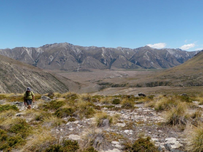
Arriving at the Ahuriri River on a sunny day with some wind, we crossed it 20 metres upstream from the vehicles. Rather than do the usual route to the run down hut a kilometre in from the river, we went straight towards the west side of the large hill which Hideaway Biv is tucked in behind. This avoided a dry swamp area with very uneven terrain. Around the back of the large hill, we continued along past the large tarn above the fenceline. There was birdlife on the tarn but not the numbers that I had seen on previous trips. Lunch at Hideaway Biv was delightful, taking in the history of names written on the corrugated iron in pencil. Lead pencils contain graphite and this reacts with the zinc coating on the corrugated iron, forming a metallic bond that cannot be erased. A former Governor General, Lord Bledisloe visited the hut in 1931. It is thought that the hut was built in the 1890s for musterers of Benmore Station. Good to see it has had a revamp recently. We then walked around and over the top of the hill behind the hut and then back to the cars. Thanks for the company.
Linda, Jac, John, Bev, Jane, Ross F, Dean and Bess.


Herbert Forest Working Bee
22 November 2015
Four members in two vehicles arrived at the Breakneck Road gate at 8.15. It was agreed that Tim and Bill would take the scrub cutter and deal to the gorse on the Swallows return loop while Robbie and John would head for Hoods Creek with the chainsaw and line trimmer. Everyone would meet back at the gate at 2pm.
Starting from the top, Tim and Bill cleared the whole of the track through the gorse section on the upper part of the Swallows return loop using the scrub cutter and slasher. Robbie and John cut and cleared all the windfalls on the Hoods Creek Track, working from both ends. They also cut back the grass, blackberry and broom at both ends of Hoods Creek and the bottom entrance to Swallows. This left the planned re-forming of the track across the replanted area at the south end of the Podocarp Track for another day.
A satisfactory day for the four who turned up.
Mt. David
Sunday, 6 December 2015
The day dawned fine, after a wet Saturday evening which had left a dusting of snow on the mountains, with a light south-westerly breeze promising to keep temperatures down. Two cars took just over an hour to ferry the seven trampers the 68km to the sign-posted turnoff from the Danseys Pass road to the top end of the Otekaieke Bridle Track. They parked by the locked gate a few hundred metres down the side road and set off on foot at about 9.20am.
The route took them across the Danseys Stream, over a paddock, past some sheep yards and down across the shallow Otekaieke River on to a 4wd track which climbed up into a valley and then forked northwards towards Mt David. Half an hour or so up the gently climbing track, the group paused for a snack and to consider options. The choice was to go up a fence line on the south-western corner of the mountain, or stay on the track, climb further to the west, and head up one of the scree-filled guts. The second option was chosen and, after climbing further on the track, they headed up the steepening slope clad in snow-rimed tussock towards a gut which promised to take them steeply, but directly to the top ridge.
It didn’t. When it became unclimbable, they clambered over or around a rocky spur to the next scree-filled gut to scramble up until it too ran out, and so on, and on – initially working around to the west and then back to the south. Finally, about 3 hours after leaving the cars, they reached the top ridge at point 1366m, paused to catch breath, and then walked for another twenty minutes to the 1412m summit, marked by a large cylindrical stone cairn. The 3600 views were stunning. Immediately to the north, the Dometts loomed with Grayson, Cone and Mt Kyeburn to the west. Further west, the Danseys Pass road could be seen snaking up the valley, flanked to the south by the snow-capped Kakanuis. Further south, Mt Dasher and the elusive Kattothyrst marked the area some of them had tramped the previous weekend. Then the long ridge of the Ben Lomonds blocked the view of the North Otago downlands, though Cape Wanbrow and the Weston escarpment could be seen. The panorama was completed by the familiar shape of Otekaieke Hill and the track down it to the Boundary Hut.
After lunch, the group struck out north-west along the top ridge, meeting up after about 2km with a 4wd track which led to a saddle and then descended to the east and south-, initially following Jacksons Creek. Some 3km down from the saddle, the track crossed the creek and headed south-west along a valley which ran parallel to and north of the Otekaieke River and Bridle Track. This track frustratingly dropped into and climbed out of a succession of side gullies but compensated by offering changing perspectives on the south side of Mt David. Finally, the Otekaieke River and the flats were re-crossed and the cars reached, 3 ½ hours after leaving the summit and 7 ½ hours after setting off; a longish day but a satisfying one as some had not climbed Mt David before, and others not for some time. It was enjoyed by Linda, Bill, Neville, Phyllis, Maurice, Jane and John.


