

ABC Cave, Silverpeaks, 14,15 March 2015
Trip Report Overnight at the ABC Cave, Silverpeaks, March 14, 15 2015
A very small contingent arrived at the Mountain Rd gate at about 9.30am after a quick stop for coffee at Vanessa’s in Hampden.
Good weather had been ordered for this weekend and was duly delivered in spades. There was no real pressure on the walkers with plenty of time to achieve our objective of the ABC Cave.
We deviated from the Yellow Ridge Track to look at the tunnels, just a 5 minute walk off the main track. The tunnels were disappointingly small. They were located along a water race which picked up water from the South Branch of the Waikouaiti . Both were leftovers from gold mining activities in both the 1860’s and later the 1930’s. There were never any great yields here.
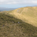
On up the ridge to the Phil Cox Hut for lunch, and along to The Gap for a look . We arrived at the ABC Cave at about 4.30pm to find that it was already occupied by 2 people. After a small rest and look at the cave we decided that it would be less crowded if the 3 of us didn’t stay so we carried on to Jubilee Hut arriving there about 6pm. The hut was empty when we arrived, but within 5 minutes the crowds started to arrive, first a group of international students, then other smaller groups. 14 people stayed the night, a further 4 moved down to the Cave Creek to camp. A busy night ahead and the big crowd making sleeping just that much harder.
In the morning we found others who had also camped the night along the creek. The weather was fine again and as we gained height going up the Devil’s Staircase it got very hot. We had elevenses at the top and then turned north to go along Rocky Ridge towards Hermit Ridge in an attempt to find the Hermit’s Cave. This was not found, but having found out more information on its location, I am confident that the next attempt will be successful. We returned to our packs quite thirsty and hungry and after lunch carried on along the ridge and eventually down to the Green Hut site to meet a group of OTMC members out for their club day trip , David Barnes was amongst them. These ones gave us the information about the Hermits Cave.
The remainder of the walk down was done in the company of this group and David kindly offered to run us up to the gate to retrieve our vehicle saving that last bit of road bashing. Coastal cloud had come in by this time and the temperature was much lower .
The customary ice-cream at Hampden was enjoyed by 2 of us while the other looked on in disgust while we polished off the much larger than average ice-cream.
This was a very enjoyable weekend trip in an often under rated area very close to home with good company and good weather.
Thanks to Steve and John for the laughs…… Robbie
Climbing up towards The Gap
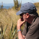
No Leidecker View here Steve.
Otekaike Hill
8-3-2015
Ten trampers met at the car park on a cool and cloudy morning all ready to get out on the hills. It was good to get out again for a hike since I had not been out on a trip for a while.
We left Oamaru and headed up the Waitaki Valley picking Bron up on the way.
Around Georgetown there were signs of the big rain dump they had on the Saturday night with 78mm falling in 15min in some places.
We went through Duntroon and turned into Special School Rd. up past Campbell Park School and along the Otekaike Bridal Track and parked up where the 4WD track that goes up the Otekaike Hill meets the bridal track. There was a strong cold southwesty blowing so it was on with some more warm clothes before we headed off. We followed a good 4WD track up a ridge beside Bushy Creek in a southwest direction for about 4km and then headed northwest to the top. It took us about 2 ½ hours to get to the top at 1172m. It was quite windy on top so we had lunch on the lee side of the trig out of the wind.
We had good views down the Waitaki Valley, up the Haka and all the high peaks like Kohurau, Domet, David, Cone, Grayson and through to the Dansey Pass.
After lunch we headed back down a ridge on the northern side of Bushy Creek following a rough track down beside a fence line till we meet up another 4WD track.
Near the bottom we detoured off the track and down a steep bank into the creek which was dry. At this point one of our Trampers realised he had left this camera at a gate back up the track so we had at sit down in the sun while he went back for it. He was soon back with us after about 20 min.
We then crossed the dry creek and up the bank on the other side to the track we had taken in the morning and soon we were back at the vehicles. It was then back to Duntroon for a ice-cream at the local cafe ( NOT ) only ice blocks on the menu.
Thanks to Bron, Linda, Rodney, Helen, Noel, Steve, Ann, Bill, John and Marcel for your company and interesting stories told for the day. Neville


Herbert Forest Working Bee
22- Feb – 2015
A drizzly morning was not enough to put off eleven worker bees willing to tackle a day’s work. Robbie as usual had the timber and pegs for the steps ready to go.
The Swallows Track was still our main focus to upgrade giving an opportunity for more people to visit this special place.
With two teams fitting the steps and another bringing in the supplies, good progress was made. A team of three started at the beginning and worked their way up to the creek cutting vegetation from the track sides and racking leaf litter off the track, while another party of two went to the other tracks to remove wind fell trees.
Lunch time and all but three gathered near the cave for a catch up and an entertaining performance by Robbie on the Didgeridoo. The day’s work ended at 2pm with a debrief at the car park. A great effort by a great team.
Jane, Bron, Bess, Phyllis, Robbie, Dave, Tim P, Noel, Dean, John – Maurice.
Hakatere Conservation Park
Hakatere Conservation Park
Glenrock Stream – Redcliffe Stream
6th – 8th February 2015
A trip with many river crossings is best with fine weather and low river flows, but with the weather forecast for high winds and snow to low levels leading into the weekend a close eye was kept on the updates hoping for an improvement.
With a team of eight, we were on the road by 8am on Friday travelling to Double Hill Run Road on the South bank of the Rakaia River. A short break was taken at Geraldine for those who needed a coffee fix.
After dropping off the team at Glenrock Stream easement the vehicles returned to Redcliffe Stream carpark where one was left for our return on Sunday. Back to Glenrock Stream Bill and Maurice set off to catch up on the advance party who were having lunch on the side of the track in the sun. The 4WD track took us into the conservation area with Turtons Saddle looming before us. A series of zig zags on an easy gradient brought us to the summit where a very cool breeze made our stay brief despite the wonderful views of down the Rakaia Valley. A skiff of snow coated the tops but the sun was still shining. It was downhill to “A” Frame hut where we passed a mountain-biker grinding up hill after a day trip into Comyns Hut. As we descended to the river terrace of the North Branch Ashburton River, Comyns Hut came into view and soon we were resting with a brew at this old 8 bunk station hut after almost 6 hours tramping. With no one else arriving, tents were not required and the cool evening had us in our sleeping bags early and for those slow to sleep, listening to the array of noises from within the hut.
A new day arrived and with it clear skies for our venture down the river. All packed and away by 7:30am the forward scouts found an old bulldozed track on the true left which we followed where possible and then the many crossings began.
It is always quite exciting not knowing what awaits you around the next bend, as the river enters the gorge section but with river levels low and water warm enough, the journey was enjoyable. Leaving the gorge section, progress improved and 5 hours later, Cookies Point was reached. A lunch break was taken by the big rock away from the nearby seagull colony. (Can’t be too careful). The day temperature had returned to Summertime and a very hot trek crossing where necessary up the Swift River to Tribulation Hut, our destination for the day. As it was only 3pm it turned into a leisurely afternoon, bathing in the river and then resting in the shade. The six bunk musterers hut has been renovated providing a tidy basic shelter for five of our party. Two tents were erected for the night with Jane testing her new tent for the first time. It was a perfect night with a clear starry sky, full moon and a very light breeze. How the weather can change within 24 hours.
Sunday morning and even Jane was up by 6:30am. with tents dry and all packed up we were on the homeward journey by 7:30am. An easy 3 hours over Redcliffe Saddle with some wonderful views across to the Craigeburn Range and up the Rakaia River brought us to the car park. A water pipe standing up out of the ground with a tap on top near the exit gate was made good use of before changing into our homeward bound clothes. After retrieving Bill’s vehicle from Glenrock we made our way to Methven for a very enjoyable lunch at the Blue Pub before returning home from a successful weekend in the company of;
Bill, John, Tim P, Bron, Jane Noel and Phyllis
Maurice.


Mt. Pisgah
1st Feb 2014
6.30 Sun am.- what a pleasure to see the sun shining ‘pinkly’’ on Pisgah with a clear-ish sky above after a somewhat claggy time in the hills. Did wonder why I was looking at it from one side, why we were travelling right around to the Maniototo side to climb it. However 11 bods were enthusiastic for this venture, even though high temperatures and thunderstorms were predicted for the day.
135km later and a bit after 10am we were ready for the climb with the Summit almost in view. It was all up, hot and humid. Relaxing over lunch with 360 degree views amongst good company, we knew it was all worth it. Tim [1] decided to use amazing ‘flying’ ability and transverse the ridge. The rest of followed a suggestion of more leisurely decent, down a ridge further north to lead back to the cars. This ended up with a rather long traverse on steep-ish terrain, and basically not such a leisurely decent as we may have imagined. It was made a little more dramatic as we watched [and some made bets] as to whether the thunderstorms would catch us or not.
A satisfied, weary 11 then made the trip home to Dunedin or returned N to our favourite icecream shop. Thanks Tim x2, Betty, Maurice, Phyllis, Noel, Bronwyn, Lynda, Bill, John.
Jane G


