


Mt. David via Razor Ridge, Sunday 9th Dec 2012
After the Club Christmas Dinner on Saturday night, eight trampers arrived at the car park the next morning to go and walk off the great food consumed. The sun was shining and a nice day looked promising. We left Bayleys yards off the Danseys Pass road at 9.30am and set off across the paddocks to the Otekaieke River. There was a good flow with some colour from the snow melt, but the temperature was very comfortable. After several crossings we came to the first side stream, where we left the river below to ascended the initially steep beginning of Razor Ridge.
The views unfolded as we gained height with the familiar sight of the peaks we had climbed previously. Razor Ridge looks almost unclimbable in places from a distance, but as we got up close there always seemed to be a way through. Lunch in a sunny spot on the ridge was welcomed as the Christmas Dinner had worn off.
From here it was much easier going to Pt 1228, the highest point on the ridge, where a cairn had been built by Noel and myself four years ago housing a Waitaki River bed stone in memory off the late Ian Rodger. Unfortunately due to the weather, animals, or poor workmanship the cairn was destroyed. A rebuild took place, but sadly the river stone was lost. Ian was in our thoughts which is what matters.
We had some down hill at last, and after crossing a swampy area it was yet again all up hill to Mt David. With photos taken and more fuel on board, we enjoyed the flat walk back to the end of the ridge while taking in the whole of the Razor Back Ridge view.
It was then a scramble down the rocky ridge to the 4WD track leading back to the valley floor, and crossing the Otekaieke River one last time. A short paddock walk back to the cars ended another great trip.
Thanks to – Ross, Noel, Colin, Robbie, Phillipa, Stuart,and Phyllis for your company and supporting the N.O.T&M.C. Programme. Maurice.


Club Night, November 2012
The November meeting was attended by 34 members.
The Club is involved in assisting with local educational programmes. The latest session in Herbert Forest with Weston School pupils saw twenty-seven 8-9year olds, 5 Club members and 2 teachers on the Podocarp Track. Sessions on Mountain Safety, for Duke of Edinburgh Awards, have been conducted in local secondary schools.
Trip Reports: Silverpeaks was visited for a good round trip including the Tunnels Track, Rocky Ridge and Pulpit Rock. The Labour Weekend trip went to the top end of Lake Ohau, up to the South Temple and the Maitland doing track maintenance and marking and walking out in quite heavy snow. A group went up Tabletop to a point looking out to Staircase Ridge.
Wednesday Walkers climbed Mt. Studholme and were rewarded with a view to the Port Hills. A walk from Anderson’s Lagoon to the Shag River mouth and back provided a wormseye view of hundreds of Stewart Island shags nesting in rows along the rocky ridges of the limestone cliffs. Tabletop was climbed and a trip to Trotter’s Gorge and Trig L saw 25 admiring a great flowering of celmisias and clematis.
Wilding pines and sweet briar were dealt to in tussock land near Omarama by some Wednesday Walkers in a group organised by DOC.
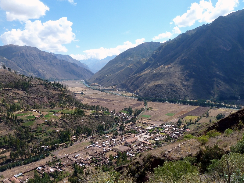
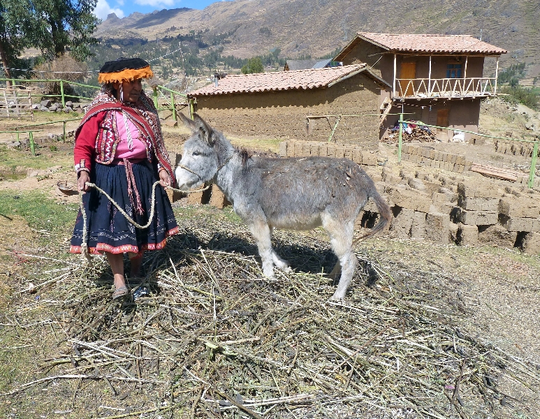
The main feature of the evening was presented by Ross Milmine – an interesting talk with wonderful photography of a trip taken by him and his wife to Bolivia and Peru. It was challenging, with long flights, 4-5a.m. starts to see sunrises, cold weather, and much travel at high altitude, between 3,000-5,000m. (Mt. Cook is 3,746m.)
The first part of the journeying was to the Urumbaba River, a tributary of the Amazon. It involved river travel, staying in jungle lodge, mosquitoes, jungle views and varied wildlife- capybara, monkeys, macaws, tarantulas and Piranha.
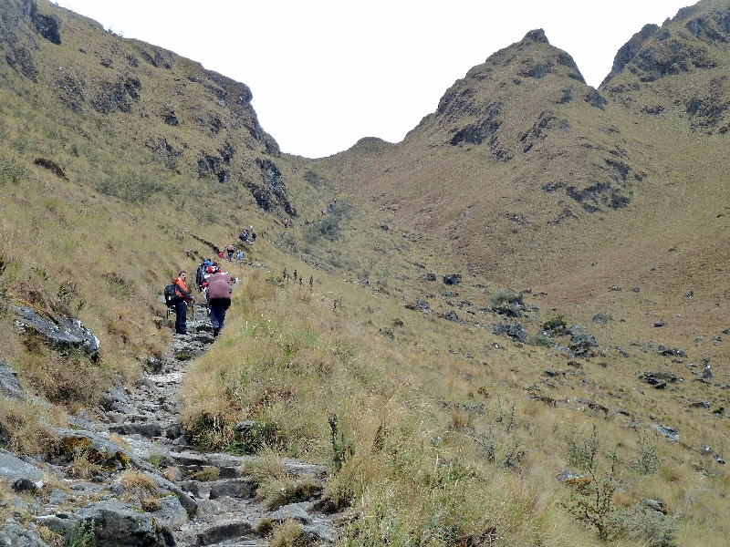
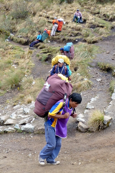
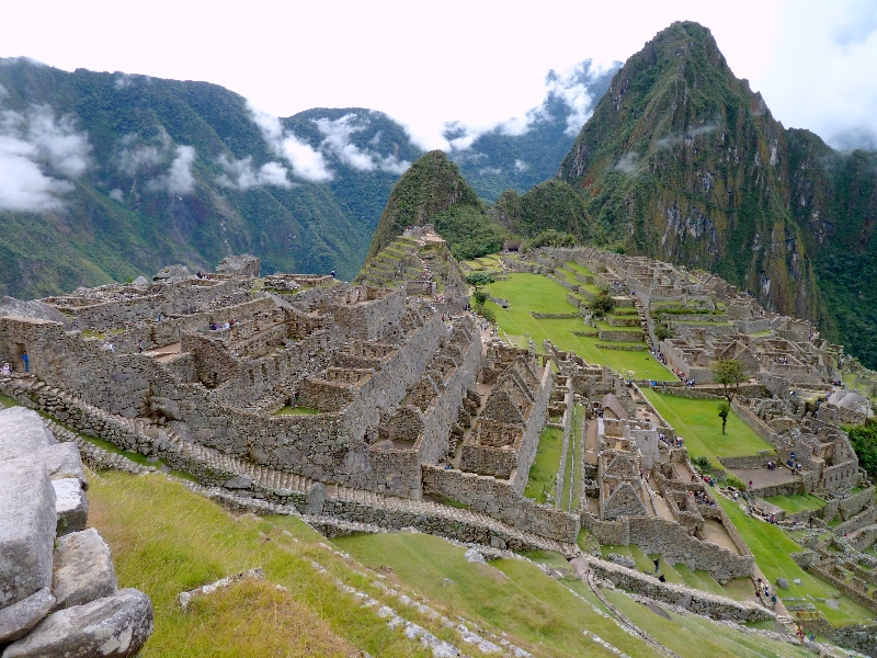
The Inca trail up to Machu Picchu took the group of 16 up and down pathways and stone steps and over passes (Dead Woman’s Pass is 4,200m), camping at night with 17 local farmers acting as porters. The oldest man to walk the Inca Trail in modern times was an 82 year old New Zealander! We saw steep hillsides terraced by the Incas and potatoes and beans are still grown at high altitudes. Harvest is a time of colourful celebration. Condors with a wingspan of 2 metres were a sight to behold as was Manchu Picchu on its high, steep and isolated site, with green grass and the ruins of ingeniously constructed buildings and water systems.
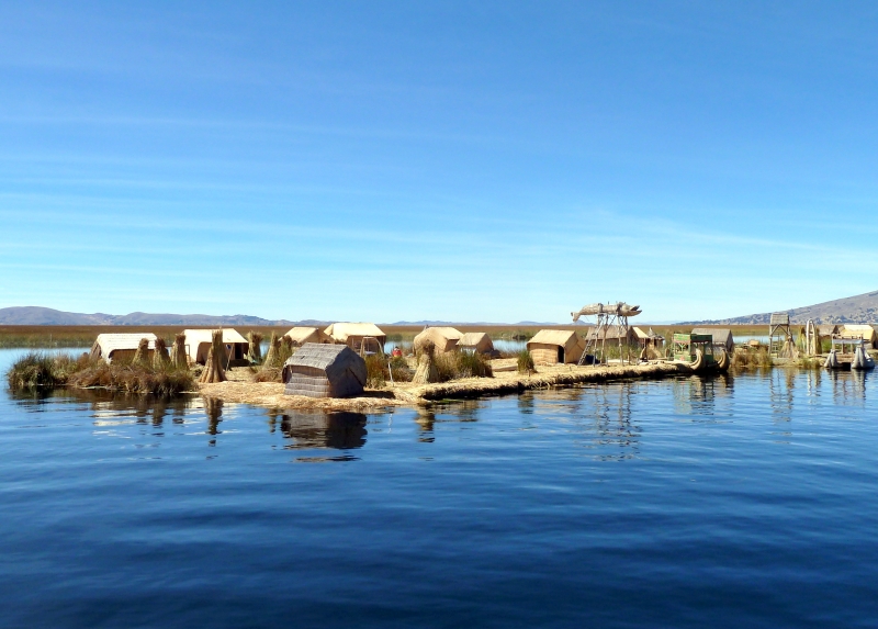
After travel to Cusco, the group went down to Puno and Lake Titicaca, the biggest lake in South America at 400km. long and 50 -100km. wide, the highest in the world. They saw reed boats and visited the reed islands lived on and owned by communities with livestock and solar-powered TV.
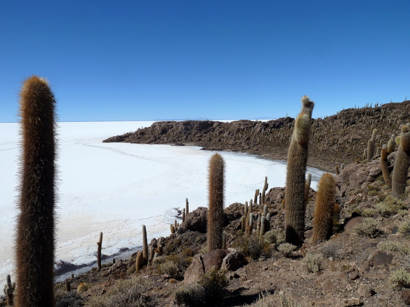
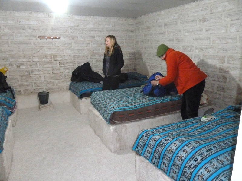
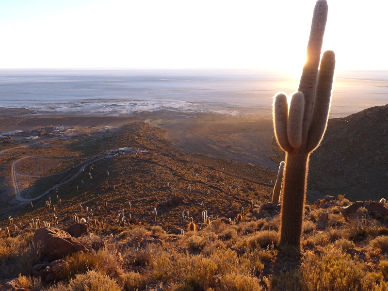
La Paz, close by in Bolivia, has a population of 2 million. From there they visited the silver mine of Potasi with 15,000 miners now producing zinc, lead and tin, and Sucre where still visible dinosaur footprints were found. The great Salt Flats of Salar de Uyuni glistened and they drove across them to an island with 2000-year old cacti. A stay in a hotel constructed of salt blocks with salt furniture was novel, and salt-edged lakes had many flamingos.
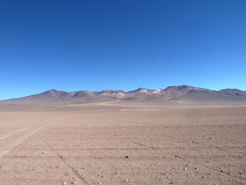
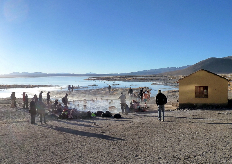
The tour ended by going up to the High Altiplano volcanic area with minus 5 degree temperature but compensatory hot pools. From the Chilean border they could see Argentina.
In spite of challenges, the excellent photography showed a great diversity of relics and ruins, stunning natural scenery and wildlife which, along with colourful and friendly people, made it a trip to remember and gave us much to enjoy.


Waianakarua Reserve to Tabletop, Sunday 4th November 2012
Spring was certainly in the air this week with the wild swing in weather conditions from hot Norwesters to snow and frosts.
A phone call from John on Sat evening based at Ohau Village reported snow down to lake level. Any trip above the bushline would encounter soft deep snow, character building maybe but from previous experience to be avoided.
Sunday, the sun was out and a fine day was in store for nine people gathered at the town departure point. After a brief disussion a new plan for the day was agreed, to fall back to an old faithful area, the Wainak Reserve.
Leaving from Mt Misery Road we headed down to the river then down stream to the track leading to Table Top. This track is now quite overgrown in places but still negotiable. A small amount of bird life was present which is encouraging to hear and see. A smoko break was taken at the bush edge of Table Top, in the sun sheltered behind the kanuka scrub from the cool southerly.
A short walk across Table Top to the S W corner gave a good view of the location of Staircase Hut and the route to and from it along Staircase Ridge. Returning to the track we visited a hunters shelter before locating a nice spot in the sun for a long lunch break.
The return journey to the rivers Middle Branch was all down hill where the decision to try the old caravan trail back to the road and return to the cars was made. This track does not get much use and is quite steep initially and is becoming overgrown with gorse. A short walk back to the cars on the road completed a nice day out with fine company.
Thanks to: Jac, Gail, Phyllis, Linda, Evelyn, Noel Robbie, Jo, – Maurice.


South Temple to Maitland Track Marking, 27th-28th October 2012

Due to the weather prospects as well as the avalanche danger in the East Branch of Steele, the advertised trip was cancelled.
However four intrepid explorers set out with tools packed to explore and mark out a route from the South Temple Hut towards the base of Mt Maitland. This trip has been done before by the club but there was always a degree of uncertainty near the beginning of the route. So the aim of this exercise was to remove this element as well as making it much easier for other parties to start this route, which also leads on to Watson Stream and on to the Ahuriri Valley.
The forecast was not great and was offering the full range of options. As it turned out it was not as bad as predicted and the 120km/h winds didn’t eventuate. Most of the heavy rain stayed away with just occasional skiffs coming over the divide.
Saturday morning saw us driving to the Temple car park and walking into the South Temple Hut. The Intentions book indicated that there were 2 hunters in residence, so a couple of tents were carried in for extra sleeping space. An uneventful walk in saw us arrive at about 1.00pm, and after a brew up and late lunch we walked up the valley directly behind the hut.
Following the side stream we eventually came to a fallen tree that allowed a crossing of the stream, and then headed downstream until we came to the second stream which we followed for some time, climbing some steep sections where needed. After some time we came to a spectacular waterfall of some 20 or more meters just where someone had whacked a piece of water pipe into the ground.
This is the stream which drains the valley that we would be working up the next day. Many photos were taken and we then walked back to the hut. The hunters had returned from their wanders too without any spoils as yet. The 2 tents were pitched to gain some space and after the usual food and tale telling, most were in bed by 9.
After a night with a bit of occasional rain, we were up bright and early the next morning and away exploring in some very wet and cold conditions to start with. Once we crossed the very slippery side stream by the hut, the climb up the exposed hill was just right for warming up.
When we got up a bit, a kea was spotted flying then landing and disappearing near the bush edge . This was unusual as none of us recalled having seen any kea in this area. We tried to see where it had gone, but to no avail and the thought was that it could be nesting here.
We climbed a bit further up the hill to the exposed ridge, and then dropped off to a long sidle to push through a route leading into the upper bush part, which eventually gives way above the bush line to the route to Maitland.
There were a few deviations but by and large we maintained a reasonable line which saw us reach the last patch of bush in good time.
Then the work commenced with us walking back exploring the best ways. We had not marked very much yet, and by and large ended quite a bit higher from where we had started earlier that day.
Then having a fairly clear idea of the best lines, we headed back in for the second time marking and snipping with loppers, until we finished back at the top of the bush line for the second time that day.
Then it was back along our marked and snipped route with much more snipping and marking, reinforcing what we were hoping to achieve until we arrived back at our starting point.
Now a large cairn marks the start of what we hope will turn into a track.
The day had been sunny at times but as it got later it got colder, and we were pleased to turn our faces hut wards and get back for hot drinks and dinner.
Much later the hunters returned and they too had had a successful day, having shot a young bull thar.
More yarns and tales were told as the weather gradually got worse. During the night it rained much harder on and off. Morning came with not much wind but the occasional rain turned into more persistent rain which then turned into snow. This followed us all the way out to the car park where it finally came to a halt.
This was an enjoyable and worthwhile weekend where we achieved exactly what we set out to do.
Thanks to Maurice, Phyllis and Noel. Robbie


