

Mt. Dryburgh, 8-6-14
Ten of us met at the car park on a clear but cool morning, all looking for a good hike for the day. We headed off up the Waitaki Valley, meeting Tim at Duntroon on the way. As we got closer to Kurow and the lakes the fog was down quite low. We all headed for the Fisherman’s Bend camping ground were we parked in a corner on the northern side of the camp by a fence.
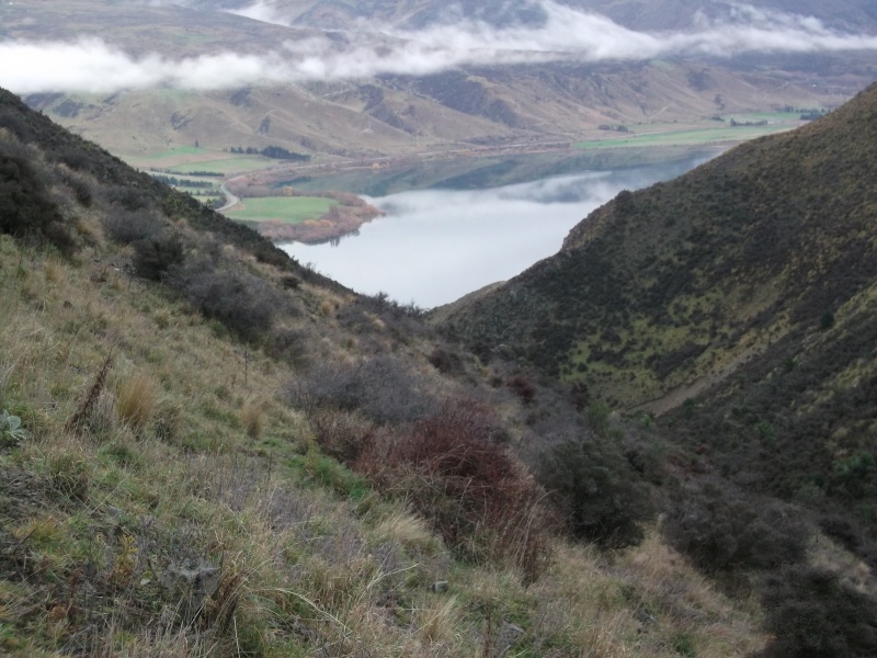
It was on with the day packs and over the fence to meet up with a farm track that headed east back down toward the Waitaki Dam on the northern side of the lake. After about an hour we came to a 4WD track that headed up a steep wee valley towards Mt Dryburgh. Half way up, the track turned east for a bit and then turned north to meet up with a main track that goes along the tops of the hills.
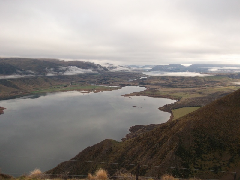
The fog had lifted a bit and we got good views of the lakes and dams, right down the Waitaki river and up the Hakataramea valley. After looking at the map and working out where Dryburgh was, we finally got to the top, which is just a high spot on the hill tops, just in time for lunch at about 12.15pm . The fog and views came and went while we were having lunch.
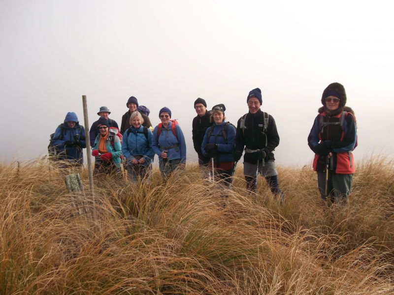
After lunch we had a photo take by the marker post and then it was off along the track heading west. By this time the fog had lifted but we still missed our turn off that was going to take us back down to the lake. It didn’t take long for us to realize our mistake and soon we were on the right track back down towards the lake.
We came back down on to the track by the lake about 2km east of where we had the cars parked, so we were soon back at the cars after about a 19 km hike for the day.
Thanks to Linda, Murray, Maurice, Phyllis, Bill, Roz, Jac, Jane, John and Tim for making it an enjoyable day out, Neville.
Big Hut – Mid-Winter 14th 15th June 2014
A night at Big Hut on the Rock and Pillars mid-Winter has become an annual event for the Tramping Club.
This year the response was less than usual with only four daring to experience the chill of a night at Big Hut. With only one vehicle and a 5km road section between both car parks, a bike was taken to retreive the car at the end of the tramp.
A forecast that was much better than previous years boded well for a clear sky and good views from the Rock and Pillar Range.
Departing from home at 8am the drive to the car park at Glencreay saw the temperature ranging from 7 deg. to-2 deg. After dropping off the bike we returned to the Lug Creek car park and began the journey up the zigzag 4wd track and on to the new Leaning Lodge for lunch.The OTMC have done a great job of rebuilding this hut.
The wind had picked up and even Colin put his long-johns on.
From the hut we went straight up to the top of the range from the first gut, and proceeded to Summit Rock on a thin layer of snow with a now very cold wind but good views in all directions.
While at Summit Rock two day trippers arrived from Big Hut, Tim Russel and Betty, also members of NOTMC, a nice surprise. It was not a place to linger too long so we moved on to our destination, Big Hut by 3pm.
With a brew to warm the inner body as the hut temperature was 6 deg. we started with a cheese and crackers entree, as there was a lot of food to get through on this mid-winter pot luck desert night.
After some table tennis and taking in the large amount of information displayed in the hut, it was time for food with a variety of beverages then deserts.
The AllBlacks test against England was listened to by various means, including sharing ear plugs on Colins radio, while Neville was in a world of his own listening to Johnny Cash (Ring of Fire) with the vocals and action to amuse the rugby listeners.
Sleep came easily with the sound of the wind outside while very comfortable in our sleeping bags.
Sunday morning and the kitchen registered 2 deg. still windy and now overcast outside. with a leisurely breakfast over, we packed and set off down the hill to the waiting bike and return of the car. With the warmer temperature and plenty of day left, we decided to visit Lake Sutton and return to Middlemarch for coffee a t Kissing Kate’s Cafe.
The homeward journey took in Macraes work site and a muddy Golden Bar Road to Palmerston, arriving home safe and well after a very enjoyable weekend with great company.
Maurice for Phyllis, Neville and Colin.


Tabletop Sunday 25 May 2104
The day dawned grey and cold and promised worse: strong north-west winds turning south-west with snow to near sea level were forecast. Given we would be driving on forestry roads to around 400m, prudence suggested taking a 4wd – and two rather than one even though there were only five of us. So we set off from town, picking up Robbie on the way, and entered Herbert Forest via Mile Flat Road. On the way up the hill, we stopped for Robbie to show us some caves not far from the road complete with Maori rock drawings. At the top of the hill we reached One Tree Ridge Road and travelled north to the entrance to Hunters’ Access #3, which would be our end point, the plan being to do the more difficult leg first in case the weather packed up. We left one vehicle there and piled into the other to head further north for about 3km, then turned left on to a loop road and parked by the track leading to Hunters’ Access #1. The track started as an easy descent through pine trees and gorse. About half way down native bush took over but so did gravity – the track became very steep with alternating tree roots, rocks and mud. However, a rope put in place by hunters made the descent less hazardous than it might have been and we reached the river (Waianakarua South Branch) an hour from the start. The river was easily crossed and a hunters’ biv near the ridge top reached another hour later after a steady climb, initially through native bush and later through scrubby manuka, and a short smoko stop. The ridge-top walk through scrub and tussock to the highest point took another hour plus time taken to search out the entrance to the return route – eventually confirmed by map and GPS. Half an hour for lunch and the threatening sky prompted movement. The return route proved to be much easier – down a ridge which never got particularly steep, across the river again and up a steady climb through bush and forest to the logged area where we had parked one vehicle. The return trip took under one and a half hours in total. We then drove back to the other vehicle and down through the forest to the Findlays Road exit and home. Bill, Neville, Robbie, Ross F and John agreed it had been an interesting excursion in a familiar area but by new routes – and the weather had delivered only a scattered shower.
June 2014 Club Night
Jane Green commenced her term as President at the Monthly Club meeting.
The Herbert Forest has been covered in a T B vector control operation, we were advised to avoid the pellets. The signs on the tracks are to be spruced up and updated.
Trip Reports;
Chinaman’s Cave in the Horse Range was approached from the Hampden side via Duncans Road. A walk down towards Pigeon Bush crossing Trotters Creek led to the hard to find cave where a wanted chinaman once hid from the authorities. Another route was taken on the return trip.
Table Top was accessed from the South Block of Herbert Forest with a very steep descent to the south Branch of the Waianakarua River, then an easier climb to the top, returning by an easier route.
Some members had a relaxing weekend at Mt. Cook village which include a walk up the Hooker Valley.
Eleven members climbed Mt. Dryburgh from Fisherman’s Bend via a climb up a 600m gut. Fog hindered some views but it cleared up in the afternoon as they walked down a ridge back to the cars. A round trip of 19kms.
The Wednesday Walkers have climbed to the Awakino ski field, some going up a steep ridge towards Mt. Kohurau before descending to the ski field. There was shin deep snow on the plateau.
Next week a walk from Kuriheka up Ram Hill road was enjoyed before a cold southerly rain arrived. Lunch was eaten in a haybarn near Tulliemet road before the return, luckily downhill with the wind.
Elephant Hill and Mussen were walked as a round trip.
Last week 36 enjoyed a fine day trip to Devils Elbow on Mt. Stalker.
Coming Club trips are Big Hut probably via Leaning Lodge, a Silver Peaks circuit of Rosella Ridge to Pulpit Rock returning via Green Hill Track, Top Dingle Hut from the Ahuriri Valley and Hideaway Biv, also from the Ahuriri Valley.
Our Guest Speaker was Club Member Gail Papps, who gave an illustrated talk on her and husband Brian’s European river cruise.
Starting at Amsterdam they travelled via a 110ft. by 22 ft. luxury river boat 4000 km through Europe to Croatia. Countries they travelled through included The Netherlands, Germany, Austria, Hungary, Romania, and Croatia along the Rhine, Main and Danube rivers with interconnecting canals.
We were treated to views of castles perched on the side of the river valleys, the superb architecture of the towns and cities and all the different types of river traffic, ranging from their cruise boat to barges with new combine harvesters on them, to double barges carrying gravel being pushed rather than towed.
Their boat could flatten its superstructure in order to get under the really low bridges, and there were traffic lights at the tight river corners.
River cruises this distance have only been possible since the 1990s when the Europa canal was opened over the continental divide, however they did have to change boats once because of a canal workers strike.
Chinaman’s Cave
Chinaman’s Cave Blue Mountains Trip Report 18/5/2014 It was good to get out tramping again after all the wet weather and trip cancellation. Nine of us met at the car park and we met two more at Hampden. The forecast was for fine weather in the morning and then a southwest change and a few showers in the afternoon. We headed up Duncan Rd in three 4WDs to park just below the microwave tower. We started hiking down an old track and then crossed a fence and sidle around the top of a gully till we reached the 4WD track that goes down to pigeon bush. As we walked down the track the birds were full of song in the bush. Half way down we turned off and headed up another track in a southwest direction. We walked along the hill tops before dropping down and crossing the top end of trotters creek which someone had made a sign and called it Christmas creek. It was then up again and we then got a view of the Lime Works on the hills opposite us. It was not long after that we came to the wee valley we had to go down to the cave. As we came down we crossed over a lot of pig rooting, they had, had a really good go. The creek where the cave is was soon reached and then it was a scramble around the rock look for the cave. I seen a worn track headed up the rocks to some bush, so I followed it and soon the cave was found. We all explore the cave for about 10 minutes, signed a visitors’ book and then it was back down to creek below the cave for lunch. After lunch we headed off along the valley floor below the lime works in a northwest direction for about 3km, past a wool shed till we came to the valley that headed northeast towards the microwave tower. We followed a 4WD track along this valley past some nice bush where the birds were busy in song again till we come to the 300m climb. After about 40 minutes we were back up on top, where we pasted the microwave tower and back along to the vehicles. Us we got back to the vehicles the first shower of rain came though so we timed it just right. The whole trip took about 5 hours. Some of the tracks we have hiked before along Duncan Rd are starting to get over grown with gorse which is a bit of a shame. Also they are going to do a 1080 drop in that area in the next few weeks. It was back down the road to Hampden for the usual ice-cream stop. Thank for the great company, Dave, Linda, Bill, Jane, John, Jo, Ross, Bess and Jane & Sara on their first day out with the club. Neville