

Trip Reports
Careys Creek – Evansdale Glen Reserve Report – 7th May 2022
Tuesday, May 24th, 2022
This trip was meant to be on the Sunday but with the weather report during the week of
rain, then clouded, then showers it was too mixed up to predict, so with Saturday being the
better day I put the word out to the club that Saturday would be the day. On the day there
was only one other club member that showed up, but with it being a new hike that both of
us had not done before in was decided we would do it and put it back on the club’s program
another time. We drove down the road towards Dunedin and just at the bottom of the
Kilmog there is a road to your right that takes you into Evansdale Glen Reserve and the start
of the track.
We headed off about 9.30am crossing the creek with no wet feet which was
good because we would have to cross it several more times on our trip. The trip up the
valley was on a good track with a mixture of native bush, open flats and a bit of a pine
forest. After about ½ hour we came to the junction of the Rongomai track, this would be the
track we would return on in the afternoon, so we carried on up the Careys Creek track
where it closed in a bit in the valley with native bush. The track followed the creek with a
few creek crossings, an old water race pipe and a small dam. Since we had had a dry couple
of months the track was petty dry, but this track had been known to be quite muddy at
times. We soon came to the junction of the Honeycomb track about 10.30 am which you
could walk right pass it if you were not looking. We found a flat area just up the Honeycomb
track where we took a break and had morning tea enjoying the bird song with the bell birds
and others and the friendly failtails keeping us amused.
After morning tea, it was a steep climb for about 20 minutes to get us on a ridge that levelled off a bit up to Steep Hill Road in
the Silver Peaks. Just before the road we came across a connecting track to the Romgomai
track, but we carried on up to the road. It was then up the road for about 5 minutes to meet
a forest road that took us down pass where the connecting track came out and on to the
start of the Rongomai Track. The Rongomai track follows a rocky ridge line back down to
Careys creek, but ½ way down we stopped for a lunch break and to admire the bird song
again, with sightings of wood pigeons and a goat calling in the valley below. The last part of
the Rongomai track drops down steeply over a creek to meet back up with the Careys Creek
track at the track junction and then it was just a back track for ½ an hour to be back out at
the car park at 1.45pm and after a 12.7 km hike. We both agreed it was a good day out and
we had made the right decision to go. We then decided there was a wee brewery at
Evansdale the both of as had not visited before, so it was off to there to finish off a great
day out.
Thank to Julian for your great company for the day. Neville


Arthurs Pass – Otehake River
Tuesday, April 26th, 2022
23-25 April 2022
A last minute change from the programme due to unfavourable weather predictions saw this trip going to the hot spring located in the Otehake River instead. Only 3 of us met up at the Morrison Footbridge at 8.30am on the Saturday, 2 had stayed the night at Arthur’s Pass Village, the other 1 coming from Greymouth. We opted to drive back to the Aicken Car park for a river crossing across the Otira River instead of taking the 4 hr walk from the Morrison Footbridge.
A pleasant walk ensued up the valley, interrupted only by a careful negotiation around an deep creek/rock feature known to some as Maurice’s Hole, named after a current member on a previous trip who had explored its full depth.
Morning tea at the turnoff to Lake Kaurapataka and on through some of the most beautiful bush anywhere to the open space half way along the length of the lake. Some of the biggest red beech trees are to be found here in a lush setting of ferns. Lunch at the lake and then on to the Otehake.
The river was high and the crossings through the gorge setting were deep and challenging and sucked the energy right out of us. It was good to arrive at the spring, quickly establishing our camp we excavated an existing hole to deliver a good supply of hot water and dammed out some of the cold running in and quite quickly we had a pool big enough for 3. Bliss! We spent some time getting wood and got a decent fire going as a focal point for the usual round of tales which saw us last until well into the night…about 8. Night time hot bath and off to the sleeping bag for a good 12 hour lie down.
It drizzled in the night and the morning was wet, so it was decided that a camp out at Lake Kaurapataka, would also be very nice. We set off with a deep river crossing near the camp and stayed on that side of the river until eventually coming across the track leading back to the lake. This was the high water route and brings you back to the top of a little pass in between the lake and the river, not a track for the fainthearted, with lots of challenges and very steep.
It drizzled in between sunny patches throughout the day some of the drizzly patches were utilized with naps in our tents, but by dinnertime things had dried off and challenged ourselves with the job of making a fire, not easy with wet wood, but with persistence and the help of a fire lighter we achieved this minor miracle and enjoyed the warmth while we ate and talked some more.
During the night the sound of Ruru and Kiwi as well the snuffling and calling of the resident Wekas around our tents kept us company.. all was good. The birds were constant and amazing, from the inquisitive robins to even the call of the Karearea.
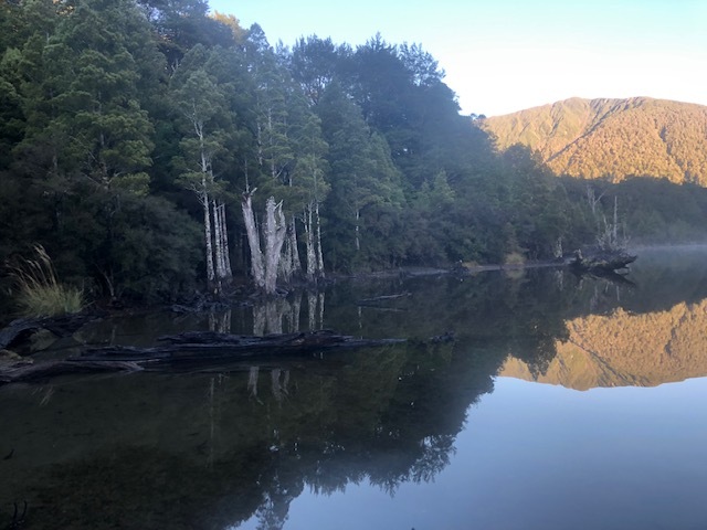
Morning was perfect.. mist on the lake, reflections of trees and mountains, no crowds, lots of bird sound and the Wekas.
After packing up we walked back to the car, nice walk again.
We did not change as usual but drove in our tramping gear back to Cave Stream near Castle Hill, shedding anything you didn’t want to get wet and donning our torches, we had a walk/ clamber through the over 500m meters of the cave. The water was deep in places, chest height and cold especially at the beginning, it rushes the whole time quite fast and waterfalls to clamber over. An eel, a fish and a spider were seen. It’s a very noisy place and it was some relief to finally come to the other end and sun shine.
It is a very impressive experience for anyone brave enough, the deep water being a challenge.
Very chuffed with ourselves we set off home after finally changing into our dry day clothes, stopping only in Stavely for a nice cuppa.
Thanks for a magic trip Julian and Jenny.
Robbie




Ben Ohau
Tuesday, April 5th, 2022
27 March 2022
Third time lucky for this trip due to weather other times this trip has been put on the programme. Three of us meet in Oamaru and with a pick up in Kurow and three other meeting us there, our party would be 7 for the day. The weather forecast was for cloud in the morning clearing early afternoon.
We arrived at the car park at the base of Ben Ohau at 9.30am and met our other three members. Ben Ohau was under cloud when we started off at 9.45am over the open grassy field towards the base of Ben Ohau. We soon started the climb up the zigzag 4WD track within the north-eastern gully and into the dense cloud, but after 1 ¼ hours of walking we eventually broke through the cloud into brilliant blue sky and sunshine at the 1100m mark.
We climbed up on to a rocky point and looked back down on the cloud covered Lake Ohau and there before us was a Brocken Spectre which is glory rings formed by water droplets within the cloud refracting the sunlight, similar to a rainbow. With the sun behind us we were able to get our shadows within it, a first for me.
Another 45 minutes later after heading off the 4WD track at 1380m point and ascending the rocky upper northern ridge we finally reached the top 1522m at 12.15pm. We had great views of all the surrounding mountains rising up out of the clouds. Lunch was had in warm sunny conditions, photos taken and the cloud was starting to lifted over Lake Ohau but Twizel was still in thick cloud.
After lunch we dropped down the north-western side of the peak to meet back up with the 4WD track again and after an hour walking, we meet the junction of the Greta Stream track. We headed down the headwaters of Greta stream with an abundance of wilding pines scattered across the slopes and into the gorge.
The beautiful gorge had towering rock outcrops and a series of small waterfalls and a small patch of beach forest. At the end of the track, it begins to drop down towards Glen Lyon Rd above the shoreline of Lake Ohau, which the cloud had cleared and it was looking stunning. We arrived back at the vehicles just after 4pm, after completing 17.7 km for the day and about 6 ½ hours walking.
Thanks too; Jenny, Colin, Donna, Julian, Rodney and Helen for your company and making it an enjoyable day out.
Neville


Mt Misery bike ride and walk to Kahikatea Lodge trip report.
Tuesday, April 5th, 2022
Six of us left Reid Road at 8.30ish. All on ebikes it didn’t take too long to get up Southridge and Middleridge Roads and a small deviation to the Mt Misery Rd car park showed that no one else was joining us that day. It’s an awesome ride going up through the Glencoe Run, with huge views wherever you look. About 10 saw us all at the end of the road car park past the Red Hut ready to start our walk. Just then a chopper came around the hill and landed right there in the paddock, discharging a hunter with dog, gear and meat. This being the first weekend of the roar, we were advised to walk in our hiviz to avoid being mistaken for game, good advice which we took. The track into the lodge is fairly newly cut and has flagging tape as markers but is not bad for a new track. It goes along a ridge and after a while plunges fairly steeply down to a creek. Roaring stags were heard throughout this decent maybe they were animals, maybe not. On the other side of the creek, there is a grassy steep slope leading all the way up to the saddle where the Kahikatea Lodge is situated. Nice hut, nice location, very nice toilet, great views. Its nearly finished with just the kitchen bench and log burner left to do inside and a covered veranda outside. It was unoccupied unexpectedly and had had no-one there for a couple of weeks according to the hut book. We had lunch here before returning the same way. A bit more of a grunt going back with more elevation to gain but we got there to be re joined by one member who had returned much earlier. The ride back to Reid Road was mostly down hill in cloudy cool conditions, but with enough time to take some of the bike track options on offer through the Herbert Forest, a very enjoyable option for those who don’t like the forest roads.
This was a most enjoyable day out close to home, a great option in these days of covid.
Many thanks to Jane and Graeme, Julia and Bob and John for joining me, Robbie


Trip Report, Working Bee Herbert Forest Tracks, 13 March 2022
Thursday, March 17th, 2022
Nine people attended this activity on a fairly grey morning. There was a fair bit of work required on the Hoods Creek Track which has been closed due to log harvesting. A crew of 5 went to work from both the top and bottom of the track. They eventually met up at about 2.30 pm and all walked back to the top and were ferried back to their vehicles. Four of us stayed at the Swallows and proceeded to lose a few kg in gravy as we pulled and pushed wheelbarrow loads of gravel past the first bridge over the creek and spread gravel over weed mat in the boggiest patches. It was very hard work unfortunately not made lighter by many hands. It would have been really good to have seen more members make the effort to come, we could have all had more fun that way and achieved much more. However it was not to be and it does not diminish the effort of those who did come nor the appreciation of those who come to walk the tracks. That morning it was very gratifying to see the number of families with young kids giving it a go with excitment and appreciation in their eyes and a little less mud on their shoes. Thank you so much for the crew who came out, they were: Maurice and Phyllis, John, Julian, Bess, Jane and Graeme, Mark and Robbie