Trip Reports
Tavora Reserve & Puketapu Hill
Monday, July 6th, 2020
5th July 2020
On a cool morning, six trampers travelled to the Tavora Reserve near Palmerston for an easy stroll out to the coast at Bobby’s Head. Racing against the incoming tide, we made our way South along the beach to breath in the sea air and view the various sculptures in the mudstone cliffs. After retreating and finding a log to sit on to have morning tea we were joined by Rodney and Helen from Dunedin.
A climb up and away from the beach took us through native plantings and out into the open where we had views of the coastline to the North and South. With a short walk along the road, we arrived back at the cars at 11.30am and then drove to Palmerston.
After parking at the lookout carpark, we set off to climb Puketapu Hill. Some took the steep direct route up to the top while others found a more gentler path. By climbing the stairs and ladders inside the monument we had some great views of the surrounding landscape. On the sheltered side we consumed lunch and then proceeded back to the cars by circling down by a more gentle slope. It was then back to Palmerston for us all for the compulsory ice cream stop. Having dodged the rain, we arrived home mid afternoon.
Phyllis


Aoraki/Mt Cook
Sunday, June 28th, 2020
20-21st June 2020
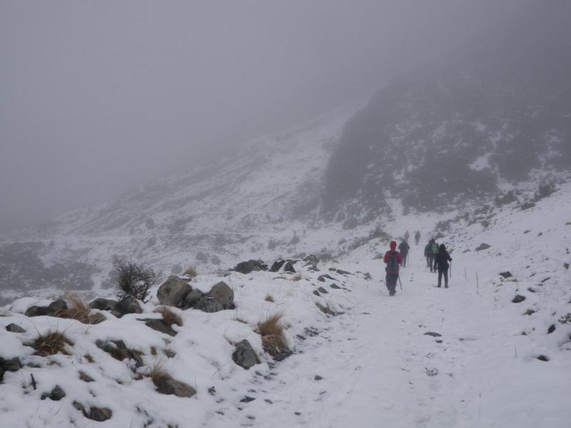
Eighteen people decided it was time to get out and head for the hills and what better place than Mt Cook when there has been a fresh fall of snow. The weather was fine even if somewhat cold.
It was a bit of a social trip but catered for everyone who wanted to get out there. After a leisurely drive with the obligatory stop at the Wrinkly Ram we arrived at Mt Cook carpark and unloaded into the Wyn Irwin Hut which has 16 bunks. We all wandered up the Hooker Valley on Saturday afternoon before settling in for a light tea followed by a very generous shared dessert.
Some of us played a couple of games like Doo Dah, Mancala and Jenga. (Maurice is a lousy liar)
Sunday morning five bods headed up to Sebastopol with ice axe and crampons through and above the fog to some spectacular views and the rest of us wandered up the Tasman valley noticing that as we gained a little height the snow was getting deeper. With the filtered light of the sun through the cloud and mist it was rather atmospheric and very pleasant. After a brief lunchbreak we returned to the cars and had a cuppa at the village before heading home.
Karyl




Exploring Silverpeaks
Thursday, March 19th, 2020
This trip was meant to go to the Rock & Pillar Range but with the forecast of rain & cloud I decided it was not the best place to be on a day like that.
I looked at the forecast closer to the coast and showers were forecast later in the day so I put the word out that we would be heading to the Silver peaks area. Three hardy trampers met on the Sunday morning in overcast conditions and it was decided to stay in the low part of the silver peaks and explore the river track up to the Philip J Cox memorial hut.
We headed south to Waitati and up Semple Rd and 1 km past the main car park we parked by the start of the Possum Hut route. From here we headed down this track, but instead of following this track all the way down, we veered right and headed down through the pine tree to come out by the Waikouaiti River South Branch a bit further down. From here we crossed the river (no wet feet} to pick up a good track on the other side. I think there is a group of people that maintain these tracks and they do a very good job. We followed this track down past the bottom of Rosella ridge, crossing Cats Teeth creek along the bottom of Hermit ridge. We found what looked to be a good track coming off Hermit ridge and another good track dropping down to the river below, which we would explore in the afternoon to see if it would get us up to Walkers Rd. We crossed another creek which was a great spot with the water flowing over smooth rock and flow into the Waikouaiti River with the bush all around.
It was then a bit of a grunt up a rough track through the bush to meet up with the Yellow ridge track and on to the Philip J Cox hut by 11.45am. Lunch was had here in warm conditions and after a rest and a look around we retraced our steps back to the bottom of Hermit ridge. We took the track we had seen in the morning down to the river thinking it might go up the river to meet up with Walkers Rd track. We knew that it was a long shot because according to the map the Walkers Rd ridge was another 1km up the river and we were right. After bush bashing on the other side for 5 min and not finding any tracks we headed back to the main track. Sure enough further up the track just before Cat Teeth creek we spotted an orange ribbon going back down to the river and another ribbon on the other side which lead into a firebreak. It was then another grunt up through the pine trees to come out on to Walkers Rd. It was then up Walkers Rd and back on to Steep Hill Rd and back to the vehicle and a light shower of rain was starting to fall. All up it was a 16km hike and took 6 ½ hours in warm overcast conditions with a light shower at the end. In the end I think it was a good option and exploring some new tracks in the Silver Peaks.
Thanks to Maurice & Phyllis for their company for the day and I know Maurice is already thinking of exploring the Hermit Ridge Track. Neville


Kurinui Trip Report
Monday, March 16th, 2020
Eleven members turned up at the bottom shop in Hampden at 8.30am on Sunday. Thanks to Maurice who organised those who usually meet at the Medway Carpark to go there. We carried on and eventually parked just below the repeater just west of Hampden.
Our walk started by going down Top Track all the way down to Kurinui Creek. The weather forecast was for greyness and that is precisely what we had. Turning up river at the bottom we went as far as the old hut which was locked and we had morning tea there. A timely reminder ensured that everyone had their lunches repacked. Down river now to pick up the track called Reserve Track on the map. This was easy enough to start with following recent track cutting but soon enough we were left with nothing much to follow and became very reliant on the Topogps app on our phones, what a great tool for helping us navigate this tricky terrain which is overgrown with a mixture of regenerating bush and gorse. After reaching some higher altitude and a decent view and a grassy flat we stopped for lunch. Looking around, the evidence of early burn offs could be seen in the revegetation on the hillsides, rocky bluffs and steep sided hills created a remote atmosphere in this location belying its close proximity to civilisation. After lunch we carried on the scramble of trackless travel, stopping only to look at views as they came along in the clearings. Eventually around Pt 405 0n the map we picked up the track again and enjoyed the last part of the walk without constant reference to our map app. The track ended surprisingly suddenly with a gate that required climbing over to get us back on the road and the last 3km walk back to the vehicles. A good day out, made so much easier with the help of our navigation app. Thanks to the drivers for getting us to the spot and back and thanks to those who came, they were;Bill, Nev, Roz, Bron, Bess, Bob, Julia, John, Maurice, Phyllis and Robbie


Orbells Cave, Waikouaiti
Monday, March 9th, 2020
Sunday 1 March 2020
It was a perfect day for tramping: clear blue sky, warm sun, and a light nor-westerly breeze only swinging north-east later in the afternoon. The drive in was long – 97 km, 24 km of which was on gravel roads in behind Waikouaiti. Blucher Road wound tortuously along a ridge south-east from Bucklands Crossing, then turned south to become Lamb Hill Road which wound its way some more to the Bendoran Huts where it became a farm track. We parked by a gate 200 metres before the huts and, just on 10 o’clock, started walking through the gate up a short hill before turning downhill and south-west. The 4wd track we were following wound around the hill before turning down a side stream to meet Orbells Creek at the bottom. It was now 10.45 so we settled down for morning tea on a sunny bank beside some stock yards.
After smoko, the track followed Orbells Creek for half an hour or so before leaving it to climb 200 metres over a saddle, drop down to a side stream, then climb again to another, flattish saddle before the final descent back to Orbells Creek, which had followed a big loop to the south. Reaching the creek, the destination caves could be seen in a prominent schist rock face above the true left. A short walk down the creek, through some yards, across the creek and up a short climb took us to the caves: two large openings in the rock offering airy shelter. One had signs of occupation – an old meat safe and a clothes line. The other had a small spring which watered a small patch of lush grass. Both had clearly provided bedding for livestock, so care was needed in selecting luncheon seating.
We had reached the caves shortly before 1 o’clock and, given the prospect of a 2 ½-3 hour climb back and the long drive home, it was decided not to go further down the valley to the Three O’clock Stream which Orbells Creek flows into and which, in turn, joins the Taieri River near Hindon. So, at around 1.30 we set off on the return journey, stopping to admire the remains of a previous al fresco party before making a fairly leisurely climb back to reach the car at around 4.30. The return to Oamaru was interrupted to enjoy the giant ice creams which are a feature of Hampden. The splendid day in interesting country new to most was enjoyed by Mark, Nicky, Kayla, Bronwyn and John.